Trip Report: Ohlone Wilderness Trail
- Ankit Jain
- Aug 16, 2021
- 6 min read
Updated: Sep 18, 2022
Backpacking the Ohlone Wilderness in California's East Bay
Check out this and many other great backpacking adventure videos on the Pathloom YouTube Channel! We've got many more videos planned for the future, subscribe to get notifications for when they go online!
Trip Info:
Trip Type: Backpacking
Season: March 2021 (Spring)
Location: East Bay, CA
Total Distance: 28 miles (21 miles hiked)
Elevation Gain: 8,300 ft
Duration: 3 days / 2 nights
Trail Type: Point-to-Point (One-Way)
Direction: North to South/East to West
Permit: Required

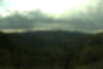
Ohlone Wilderness, CA - Photo Credit: Ankit Jain
Overview:
The Ohlone Wilderness Regional Preserve was named for the Ohlone Tribe that populated most of California's Bay Area for thousands of years before the onset of European colonialism. This time last year, nearly half of the area's 9,737 acres were impacted by the SCU Lightning Complex Wildfire - but as the video and photos show, the resilience of this chapparal biome allows for rapid regeneration of the region's plantlife less than 6 months after such devastation.
The Ohlone Wilderness Trail is a difficult/strenuous backpacking trip with mostly moderate to steep terrain. For those in the Bay Area planning to attempt long distance thru-hikes like the Tahoe Rim Trail, the John Muir Trail or the Pacific Crest Trail, it is often referred to as the “training hike” due to the constant up-and-down nature of the trail. Most complete thru-hiking the trail within 2 or 3 days, starting at Del Valle Regional Park and finishing at Mission Peak in Fremont, CA.
There are notorious sections like the “Big Burn,” which is a steep 1,100 ft climb spanning just over a mile. The steepest section of the trail is from Del Valle to Schleiper Rock. Most of the trail goes through rolling hills, with views of the surrounding cities. The trail also traverses through grazing land, seasonal Murietta Falls and peaks such as Rose Peak (at 3,817 ft, it’s the highest peak in Alameda County) and Mission Peak.
During the summer, the hot temperatures make the trail difficult, hence a spring or late fall trip makes for more favorable hiking conditions. Water is available in certain campsites along the trail, however it requires filtration. I’ve traversed this trail multiple times, but on this trip I wanted to explore campsites I hadn’t stayed in before. However this time around, we unfortunately had to cut our hike short in Sunol due to incoming storms and the sun setting before we had a chance to complete the final 7 miles up and down Mission Peak.

Ohlone Wilderness, CA - Photo Credit: Ankit Jain
Trip Planning:
Permits:
Permits are required for hiking the Ohlone Wilderness Trail, and separately for parking and camping as well. The trail permit is $2, and is valid for an entire year. Trail permits can be purchased online, or picked up in person - which comes with a map of the entire trail (including an elevation profile).
Camping:
There are multiple campgrounds along the trail, most of which require some off-trail mileage to reach. Dispersed camping is prohibited in the Ohlone Wilderness, one must stay in a designated campsite - all of which require reservations. More information on backpacking campsites and reservations can be found here: https://www.ebparks.org/activities/camping/backpacking.htm.

Ohlone Wilderness, CA - Photo Credit: Ankit Jain
Itinerary:
Day 1: Del Valle to Boyd Camp
We began our journey by driving to Mission Peak trailhead, where I left my vehicle parked. We then took a Lyft to Del Valle Regional Park, to the starting trailhead near Ardilla Group Camp. The gate was closed after the bridge due to COVID, so we had to walk an additional 0.5 miles to the trailhead. We had a quick lunch, and then hiked out to Boyd Camp where we camped for the night. There was an outhouse and two campsites, both of which required reservation via telephone. Along the way, we caught views of Del Valle as we climbed out and we stopped to refill water at Stromer Spring, which was about 0.5 miles before Boyd Camp.
Total Distance: 2.7 miles
Day 2: Boyd Camp to Maggie’s Half Acre
We woke up early before sunrise and hiked out towards the Big Burn. We missed a trail sign and ended up taking an incorrect trail for about 1.5 miles. We caught the sunrise at an overlook around the same time we realized we were off our trail. Once we made our way back, we saw where we missed the junction, and got back on the Ohlone Wilderness Trail. It was funny as I’ve done this trail multiple times before, and couldn’t believe we missed the blatantly obvious sign - happens to the best of us I suppose! We then made our way down a steep ravine to Williams Gulch, and began our slow climb up the Big Burn. Reaching Schlieper Rock, we took a lunch break and continued onwards toward Rose Peak. We stopped at Stewart’s Camp to refill our water, and carried on. Once we made our way up to Rose Peak, nearing the junction for Maggie’s Half Acre, I noticed an animal jump into the bushes - from what I gathered, it could’ve been a bobcat or mountain lion. We scouted for a bit at the top of the ridge to see if we could notice any further movement, but heard nothing else. We then made our way to our campsite for the night - Maggie’s Half Acre. There is water and an outhouse at this campground, located just behind Rose Peak. During the night the fog rolled in, which created quite a unique experience to step out into the fog.
Total Distance: 8 miles
Day 3: Maggie’s Half Acre to Sunol
We began our morning with some breakfast, packed up our camp, and hiked up to Rose Summit. We then made our way towards Mission Peak via Sunol. We reached Sunol Backpack Camp in the late afternoon passing through Goat Rock and a lot of downhill hiking. We had a quick snack at Sunol Backpack Camp and carried on. By the time we reached the Sunol Visitor Center, the sun had already set and stormclouds were rapidly gathering over Mission Peak. At that point we were left with no choice but to forego the final 7 miles of the trail to Mission Peak, and instead headed down to the Visitor Center parking lot. From there, we had a friend come pick us up and drive us back to our car at the Mission Peak parking lot, thus concluding our journey.
Total Distance: 11 miles
Ohlone Wilderness, CA - Photo Credit: Ankit Jain
Gear List (with Links):
Backpack & Storage:
Backpack: Gossamer Gear Mariposa 60
Backpack Rain Cover: Osprey Ultralight Raincover
Shoulder Water Bottle Holder: Gossamer Gear Bottle Rocket
Fanny Pack: Gossamer Gear Bumster
Dry/Stuff Sack: Osprey Ultralight Dry Sack
Smell/Odor Proof Sack: LOKSAK Odor Proof Storage Bag
Hiking:
Shoes: Oboz Sawtooth II
Gaiter: Black Diamond Talus Gaiter
Trekking Poles: REI Co-op Flash Carbon Trekking Poles
Sun Protection: Outdoor Research Sun Runner Cap
Sunglasses: Oakley Sunglasses
Bandanna: Cotton Bandana
Mask: Face Mask with Vent
Shelter:
Tent with Rain Fly: ALPS Mountaineering Lynx 1-Person Tent
Tent Footprint: ALPS Mountaineering Lynx 1 Floor Saver
Stakes: MSR Ground Hog Stake Kit
Sleep System:
Sleeping Bag: REI Co-op Igneo Sleeping Bag
Sleeping Pad: NEMO Tensor Insulated Sleeping Pad
Camp Kitchen:
Fuel: MSR Fuel (Isopropane)
Cookpot: Stanley 24oz Kettle
Lighter: BIC Lighter
Cup: Sea to Summit X Cup
Food:
Breakfast: Kapka Instant Poha, Quaker Instant Oatmeal, and Green Tea
Snacks: Justin’s Almond Butter and Clif Bars
Dinner: Backpacker’s Pantry
Hydration:
Clean Water Bag: Platypus Big Zip EVO Reservoir (3.0L)
Dirty Water Bottle: LIFEWTR 1L
Flask: Nalgene Flask (12oz)
Clothing:
Tools, Electronics and Miscellaneous:
Headlamp: Vont LED Headlamp
Camera: Sony Cyber-Shot RX100 V
Extra Camera Batteries and Memory Cards
Tripod: Sunpak TravelSmart 50”
Power Bank: Solar Power Bank
Watch: Casio Sports Watch
Camp Slippers: Skechers Performance Go Walk Flip Flop
Portable Speaker: Jabra Solemate Mini
MP3 Player: Apple iPod Classic (120 GB)
Flask: Nalgene Flask (12oz)
Hygiene:
Emergency/First Aid:

Ohlone Wilderness, CA - Photo Credit: Ankit Jain
Check out this and many other great backpacking adventure videos on the Pathloom YouTube Channel! We've got many more videos planned for the future, subscribe to get notifications for when they go online!
Disclaimer: This post may contain affiliate links. In exchange for referring sales, we may receive a small commission to help us keep the lights on here at Pathloom. This comes at no extra cost to you.
Check out these other articles by Pathloom which you may enjoy:
Sign up on our website for exclusive early access to the Pathloom BETA app, and let us help you plan your next outdoor trip! As an early user, you will receive exclusive access to our BETA app, outdoor guides, and information - created solely for you by Pathloom!
Sign up today and we will send you a list of our favorite dispersed camping places in California!
Pathloom is a Bay Area-based technology startup on a mission to get more people outdoors, more often by reimagining the way people discover the outdoors.
